Russia’s coastline includes seas and oceans stretching along 40,000 km. Wave energy varies between 29kW/M – 35 kW/M (Myslenkov et al., 2023) The researchers investigated on and offline mapping and methodologies forecasting wind and wave movements. They developed an open-access atlas so that anyone can get updated wind and wave information. This is now available at: https://carto.geogr.msu.ru/ wavenergy
They used the WW3 spectral model which reconstructs wave fields, analysing wind speed, ice concentration, energy transfer from wind to waves, crest behaviour, friction, reflection, floating objects etc. They used physics modelling , tested ice patterns, wind speeds and developed wave simulations. They reviewed bathymetry topographical data based on the Bathymetric Chart of the Oceans 2019 (GEBCO, https://www.gebco.net/ ). They used buoy and satellite significant wave height (SWH) data for quality assessment.
To make the atlas accessible online, they used open source web, GIS data servers and database systems where a user opens a web client to retrieve results from the servers, for example
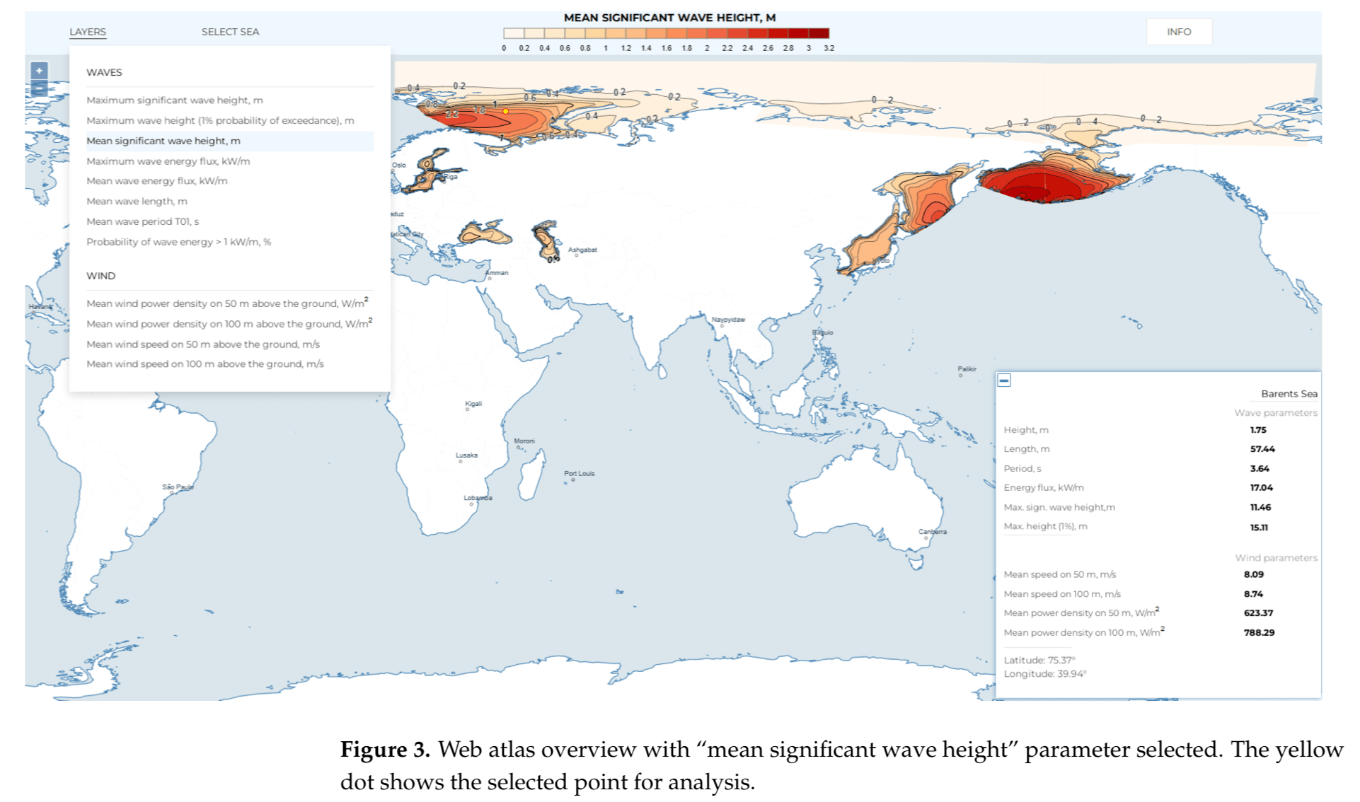
Users will be able to view updated images and data across all seas simultaneously, zooming on different characteristics of wind and wave energy. This can also help identify patterns of coastal vulnerabilities with increases in extreme weather events.
Myslenkov S, Samsonov T, Shurygina A, Kiseleva S and Arkhipkin V 2023 Wind Waves Web Atlas of the Russian Seas Water 15 2036 Online: http://dx.doi.org/10.3390/w15112036

